GeoWGS84 Corp Acquires LizardTech Suite of Products, Including GeoExpress and the MrSID Format. Click here for details
Aerial Images and LiDAR Data Compression Software
Compression is a software-based technique used to reduce the storage requirements of raster datasets by decreasing the amount of data needed to represent an image. Raster files, especially those containing high-resolution satellite imagery, aerial photographs, or geographic information, can occupy significant disk space and require considerable bandwidth for sharing and distribution. Compression addresses these challenges by encoding data more efficiently, resulting in smaller file sizes while preserving the usefulness and accessibility of the raster information.
Compression methods are generally classified into two categories: lossless and lossy. Lossless compression retains all original information and allows the dataset to be reconstructed exactly as it was before compression. Lossy compression, on the other hand, removes selected data to achieve greater size reduction, often with minimal visual impact. By reducing file size, compression improves storage efficiency, accelerates data transmission, enhances system performance, lowers storage costs, and facilitates easier management, processing, and distribution of raster datasets across various GIS, remote sensing, and image analysis applications.
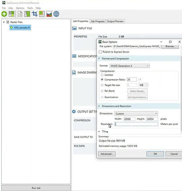
Image compression techniques are generally classified into two main categories: lossless and lossy compression. Lossless compression preserves every piece of information contained in the original image, ensuring that the compressed image can be restored exactly to its original form without any degradation in quality. This type of compression is particularly important in applications where data accuracy and integrity are critical, such as scientific analysis, mapping, and archival storage. On the other hand, lossy compression reduces file size more aggressively by permanently removing certain image details and redundancies that may be less noticeable to the human eye. While this results in much smaller storage requirements and faster data transmission, it can also lead to a slight reduction in image quality. In Geographic Information Systems (GIS) and remote sensing, both compression approaches are widely used depending on project requirements. Popular image compression formats include MrSID (Multiresolution Seamless Image Database) and JPEG2000, both of which are designed to efficiently manage large geospatial datasets while maintaining acceptable image quality and performance.
For more information or any questions regarding our services, please don't hesitate to contact us at
Email: info@geowgs84.com
USA (HQ): (720) 702–4849
India: 9009471866 - Jay Sharma
Canada: (519) 590 9999
Mexico: 55 5941 3755
UK & Spain: +44 12358 56710