GeoWGS84 Corp Acquires LizardTech Suite of Products, Including GeoExpress and the MrSID Format. Click here for details
Construction Site Drone Monitoring
Construction site drone monitoring refers to the use of UAVs to collect real-time aerial images, videos, and data across all stages of a construction project. These drones offer a broad, high-level perspective of the entire site, allowing engineers, project managers, and stakeholders to observe ongoing work with greater accuracy and efficiency.
By using drones, teams can continuously track project progress, verify structural development, and monitor the placement of materials, machinery, and equipment without relying heavily on manual ground inspections. This improves safety by reducing the need for personnel to access potentially hazardous areas and also saves time compared to traditional surveying methods.
In addition, drone-based monitoring helps in identifying site issues early, such as delays, layout errors, or resource mismanagement. The captured data can be processed into maps, 3D models, and reports that support better planning and decision-making. Overall, construction site drone monitoring enhances productivity, improves communication among stakeholders, and ensures more accurate, efficient, and safer project execution throughout the construction lifecycle.
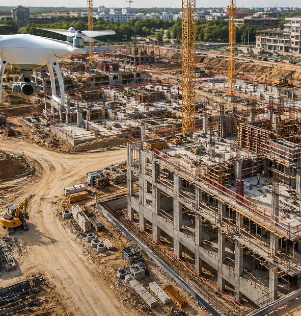
Drone monitoring using high-resolution imagery and geospatial data significantly improves the way construction projects are planned, managed, and evaluated. By capturing detailed aerial visuals of sites, drones enable teams to make more informed decisions, enhance safety measures, and streamline overall project execution. This technology allows for precise tracking of construction progress, helping stakeholders identify delays, risks, or potential issues at an early stage before they escalate into costly problems.
In addition, drone-collected data supports the development of accurate site maps, 3D models, and comprehensive documentation, which are essential for design validation and project reporting. These insights improve communication between teams and ensure that all stakeholders have access to up-to-date site information. As a result, drone monitoring contributes to better planning accuracy, improved operational efficiency, and reduced project costs. From initial groundwork to final completion, it provides continuous oversight that enhances control, accountability, and overall project success.
For more information or any questions regarding our services, please don't hesitate to contact us at
Email: info@geowgs84.com
USA (HQ): (720) 702–4849
India: 9009471866 - Jay Sharma
Canada: (519) 590 9999
Mexico: 55 5941 3755
UK & Spain: +44 12358 56710