GeoWGS84 Corp Acquires LizardTech Suite of Products, Including GeoExpress and the MrSID Format. Click here for details
What is GIS (Geographic Information System)?
A Geographic Information System (GIS) is a computer-based system used to capture, store, manage, analyze, manipulate, and display geographic or spatial data. It integrates hardware, software, spatial databases, and skilled professionals to efficiently handle location-based information. GIS allows users to understand patterns, relationships, and trends in geographic data by organizing information tied to specific locations on Earth. It supports the visualization of spatial data through maps, aerial photographs, satellite images, and other geospatial datasets. By layering and analyzing different types of geographic information, GIS helps in solving complex real-world problems such as urban planning, environmental monitoring, disaster management, transportation planning, and resource allocation. It is widely used in both public and private sectors, making it an essential tool for spatial analysis, decision-making, and effective geographic visualization.
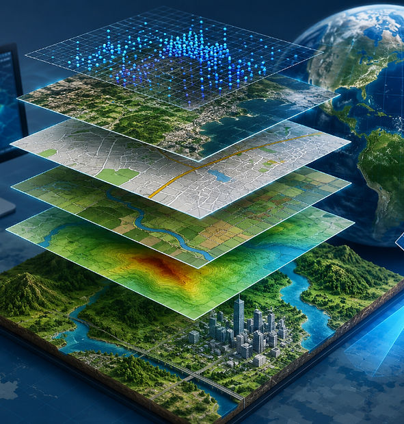
Geographic Information Systems (GIS) play a crucial role in a wide range of fields, including urban and regional planning, environmental management, transportation systems, agriculture, disaster risk reduction, and natural resource conservation. By integrating multiple layers of spatial data and attribute information, GIS enables users to visualize, analyze, and interpret geographic patterns and relationships that are often difficult to detect using traditional data analysis methods. It supports advanced mapping, spatial modeling, and geospatial analysis, allowing decision-makers to evaluate scenarios and plan more effectively. GIS is widely used for identifying trends, monitoring changes over time, and optimizing resource allocation. Its ability to combine location-based data with analytical tools makes it a powerful technology for solving complex real-world and geographic problems, improving decision-making processes, and supporting sustainable development across various sectors.
For more information or any questions regarding our services, please don't hesitate to contact us at
Email: info@geowgs84.com
USA (HQ): (720) 702–4849
India: 9009471866 - Jay Sharma
Canada: (519) 590 9999
Mexico: 55 5941 3755
UK & Spain: +44 12358 56710