GeoWGS84 Corp Acquires LizardTech Suite of Products, Including GeoExpress and the MrSID Format. Click here for details

Topographic Correction
Topographic correction plays a major role in image preprocessing in remote sensing and GIS, as it eradicates discrepancies in illumination that arise from variations in the slope, aspect, and geometry of the terrain. In areas with a huge range of relief, different land covers may appear in different colors according to their position towards the sun. Topographic correction allows for eliminating these effects of the terrain and obtaining more consistent images from satellites. The applications of topographic correction include land cover classification, monitoring plant life, and environmental assessments. By providing a higher radiometric uniformity in the complex terrain, topographic correction assists GIS professionals and researchers in acquiring more accurate information from the images. The most commonly used methods for topographic correction include cosine correction and C-correction, among others.
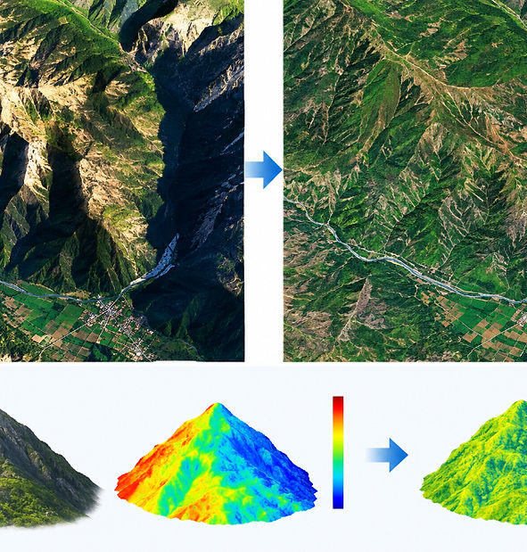
Topographic correction is an enhancement procedure of remote sensing images that minimizes radiometric differences caused by the influence of elevation and slope of the terrain and solar radiation conditions. If the relief is uneven, shadows and brightness variations appear, and the same land-use types may look different in two different satellite images. The application of topographic correction allows us to achieve consistency in illumination impacts and consistent surface reflectance data. It is widely used in satellite image processing, GIS, vegetation mapping, forest monitoring, land cover classification, terrain analysis, and monitoring of environmental conditions. Topographic correction is performed with the help of satellite images and digital elevation model (DEM) which provides information about the influence of the terrain and solar angles. Such methods as Cosine correction, C-correction, and Minnaert correction may be used for enhancing the quality of satellite images and consequently making geospatial calculations more trustworthy, especially in the mountains and regions with uneven relief.
For more information or any questions regarding our services, please don't hesitate to contact us at
Email: info@geowgs84.com
USA (HQ): (720) 702–4849
India: 9009471866 - Jay Sharma
Canada: (519) 590 9999
Mexico: 55 5941 3755
UK & Spain: +44 12358 56710