Top 10 Free GIS Software for Mapping in 2025
- Anvita Shrivastava

- Aug 12, 2025
- 3 min read
Updated: Aug 13, 2025
Geospatial analysis remains a vibrant area in 2025, and free GIS software is becoming increasingly powerful. This list of the best tools, which enable sophisticated mapping, spatial modelling, web services, and data analysis without the need for license fees, is suitable for both experienced analysts and aspiring geospatial developers.
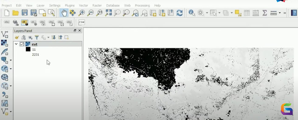
With its extensive cross-platform compatibility (Windows, macOS, and Linux), rich cartographic design, multi-format support, and more than 2,000 plugins, QGIS is a time-tested favourite that makes anything possible, from 3D mapping to atlas building. It is still the most feature-rich free GIS program on the market.
A potent tool for visualizing geospatial data, GeoViewer is made to show, examine, and evaluate geographic data. It allows users to interact with geographical data for improved decision-making in domains such as location-based services, environmental monitoring, and urban planning by supporting a variety of map formats and layers.
More than 350 modules are available in GRASS GIS for image processing, raster/vector analysis, temporal modelling, and robust geographic modelling. It is essential for complex analytical procedures due to its scripting capabilities and interaction with QGIS.
Even if its analytical depth is limited in comparison, Google Earth Pro is outstanding for visual mapping, exploration, and presentation since it offers high-resolution imagery, 3D visualizations, and the ability to import and export GIS data.
With its robust support for formats, geoprocessing, 3D visualization, and field/mobile use, gvSIG is an established open-source desktop GIS that prioritizes interoperability. This makes it perfect for workflows that combine desktop and mobile GIS.
This plugin-friendly, lightweight GIS application provides basic analysis and rapid map production. It's ideal for those looking for specialized, expandable mapping tools because it supports modular plugins and hydrology-specific tools like TauDEM.
With over 400 geospatial tools, Whitebox GAT is an open-source geospatial toolkit designed for advanced scientific and educational use. It excels at analysing raster and LiDAR data, particularly hydrology and terrain modelling.
SAGA GIS is well-known for its high-performance terrain analysis and provides tools for morphometric operations, hillshading, and watershed delineation. It is a good option for environmental modelling because of its combination of scripting and a graphical user interface.
OpenJUMP, which is based on Java and is very expandable, is suitable for basic geospatial jobs since it can handle big datasets with reliability, supports databases, GPS, and raster/vector processing plugins, and provides customized mapping.
With its user-friendly interface, support for WMS/WFS/WPS, and OGC standards, uDig is designed for internet GIS and is perfect for incorporating online mapping services into desktop workflows or light analytical tasks.
Now under a GPL license, the Integrated Land and Water Information System provides robust documentation, remote sensing capabilities, digitizing, and smooth raster and vector processing, all of which are very useful in window-based applications.
In 2025, free GIS software will be more robust and widely available than before. These tools offer an affordable means of carrying out mapping, analysis, and visualization, regardless of your level of experience with GIS analysis.
For more information or any questions regarding GIS software, please don't hesitate to contact us at
Email: info@geowgs84.com
USA (HQ): (720) 702–4849
India: 98260-76466 - Pradeep Shrivastava
Canada: (519) 590 9999
Mexico: 55 5941 3755
UK & Spain: +44 12358 56710


Comments