What is Geospatial or GIS Data?
- Anvita Shrivastava

- Apr 28, 2025
- 3 min read
Updated: May 5, 2025
In today’s digital world, geospatial data influences everything from urban navigation to government infrastructure planning. But what is geospatial data, and why is it so important?
What is Geospatial Data?
Geospatial data refers to data that is connected to a specific location on Earth. It includes information about physical features like mountains, rivers, roads, and buildings, as well as human-made structures and even weather patterns. Simply put, if data has a location tied to it — longitude, latitude, address, or postal code — it’s geospatial data.

Examples of geospatial data include:
GPS coordinates
Maps
Weather data
Land surveys
This type of data is essential for a wide range of industries, including urban planning, transportation, environmental science, and marketing.
Why is Geospatial Data Important?
The importance of geospatial data cannot be overstated. Here's why:
Better Decision-Making: Governments and businesses use geospatial data to make informed decisions, from disaster response to retail site selection.
Efficient Resource Management: Farmers use it for precision agriculture, optimizing planting and harvesting.
Enhanced Navigation: Apps like Google Maps or Uber rely heavily on accurate geospatial data.
Environmental Monitoring: Scientists track changes in climate, deforestation, and urban sprawl using geospatial data.
By understanding patterns and trends through spatial analysis, organizations can improve operations, reduce costs, and deliver better services.
Types of Geospatial Data
Geospatial data can be divided into two main types:
Vector Data: Represents geographic features using points, lines, and polygons.
Points: Cities, landmarks, or GPS locations.
Lines: Roads, rivers, or pipelines.
Polygons: Borders of countries, lakes, or forest areas.
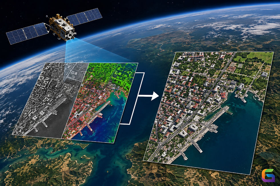
Raster Data: Represents continuous surfaces, like satellite images or aerial photographs. Raster data is made up of pixels, where each pixel has a value representing information like temperature or elevation.
How is Geospatial Data Collected?
Collecting geospatial data involves several methods:
Satellite Imagery: Captures large areas for environmental and mapping purposes.
Drones: Provide high-resolution, up-to-date images of local areas.
GPS Devices: Gather accurate location data for mapping and navigation.
Surveying Equipment: Measures distances and angles on the ground for construction and land development.
Mobile Apps: Everyday apps collect geospatial data from users' smartphones (with consent).
Applications of Geospatial Data
Geospatial data is transforming industries globally. Some key applications include:
Urban Planning: Designing smarter cities with better infrastructure.
Disaster Management: Identifying risk areas and optimizing response efforts.
Military and Defence Applications
Environmental Monitoring
Agriculture and Food Security
Transportation and Navigation
Healthcare: Tracking disease outbreaks.
Future of Geospatial Data
Geospatial data is becoming even more powerful with advances in artificial intelligence and machine learning. Real-time geospatial analytics will soon allow for instant decision-making in everything from autonomous vehicles to smart cities.
Moreover, the rise of open-source mapping platforms and affordable data collection methods is democratizing access to geospatial technology, making it easier for businesses of all sizes to benefit.
Geospatial data is more than just maps — it's a critical tool for analysing our world and making smarter decisions. Whether you're navigating traffic, launching a new business, or fighting climate change, geospatial data is shaping the future.
If you want to learn more about our geospatial data offering, please feel free to contact us.
Email: info@geowgs84.com
USA (HQ): (720) 702–4849
India: 98260-76466 - Pradeep Shrivastava
Canada: (519) 590 9999
Mexico: 55 5941 3755
UK & Spain: +44 12358 56710


Comments