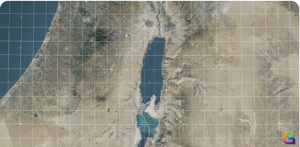
AW3D: Advanced 3D Global Map Data for GIS & Analysis
- Anvita Shrivastava

- Sep 15, 2025
- 3 min read
In the present data-driven world, high-resolution 3D geospatial information serves as a fundamental element for various industries, including urban planning, disaster management, defense, infrastructure, and environmental monitoring. AW3D (Advanced World 3D) is one of the most advanced solutions, distinguished as a global-scale 3D map dataset aimed at precision, consistency, and versatility.

What is AW3D?
AW3D is a dataset comprising a high-resolution global 3D map, developed collaboratively by NTT Data and RESTEC (Remote Sensing Technology Center of Japan). It is produced from satellite images through advanced techniques in photogrammetry and image processing.
Essential characteristics consist of:
Worldwide Accessibility – Can be accessed globally, even in remote or hard-to-reach areas.
High Resolution – Spatial resolution varies from 0.5m to 5m, depending on the product tier.
Precision – Vertical precision is within a few meters, making it appropriate for engineering-grade analysis.
Scalable – Offers various levels of detail to accommodate different project requirements.
AW3D Product Tiers
AW3D provides various datasets tailored for different applications:
AW3D Standard – Offers global coverage at a 5m resolution for extensive mapping and analysis.
AW3D Enhanced – Elevation models with high accuracy and a resolution of 2.5m or finer.
AW3D Ortho – Orthorectified images for precise base maps.
AW3D Building – 3D building representations (LOD1/LOD2) for urban development, smart city initiatives, and simulations.
AW3D Metro – Data with ultra-high resolution (0.5m–1m) for detailed urban zones.
Applications of AW3D in GIS & Analysis
Stadtplanung & smarte Metropolen
With precise digital replicas, planners can visualize three-dimensional urban landscapes, assess skylines, and model infrastructure initiatives.
Management of Disaster Risk
By offering accurate models of terrain elevation, AW3D facilitates flood simulation, evaluation of landslide risk, and planning for evacuation.
Protection & Security
AW3D is utilized by military and defense agencies for line-of-sight analysis, mission planning, and enhancing situational awareness.
Telecoms
3D building and terrain models assist in optimizing the placement of cell towers, analyzing radio propagation, and deploying 5G networks.
Surveillance of the Environment
AW3D is utilized by researchers for forestry analysis, watershed management, climate modeling, and detecting changes in land use.
Engineering & Infrastructure
By offering precise terrain and surface data, AW3D aids in the planning of roads, railways, and utility corridors.
Why Choose AW3D?
Uniformity – A Global dataset that is consistent across borders for international projects.
Scalability – From national mapping to detailed metro-level insights.
Time Efficiency – Quicker access in comparison to conventional ground surveys.
Cost-Effective – In numerous instances, it achieves high accuracy at costs lower than those associated with LiDAR.
Compatibility – Offers seamless integration with widely used GIS platforms such as ArcGIS, QGIS, and AutoCAD.
AW3D vs Traditional Mapping Methods
AW3D offers rapid global coverage at scale, making it suitable for projects with critical time and cost constraints, unlike LiDAR or ground surveys. Although LiDAR provides ultra-high precision, AW3D fills the void by offering near-LiDAR quality data that is much more accessible and cost-effective.
AW3D is transforming how professionals access and use global 3D geospatial data. No matter if your focus is on smart city initiatives, ecological studies, or major infrastructure projects, AW3D provides trustworthy and scalable datasets that enhance decision-making processes.
With the ongoing adoption of GIS-driven workflows across various industries, AW3D will become ever more vital for guaranteeing precision, efficiency, and innovation.
For more information or any questions regarding AW3D, please don't hesitate to contact us at
Email: info@geowgs84.com
USA (HQ): (720) 702–4849
India: 98260-76466 - Pradeep Shrivastava
Canada: (519) 590 9999
Mexico: 55 5941 3755
UK & Spain: +44 12358 56710


Comments