Digital Elevation Model: Everything You Need to Know
- Anvita Shrivastava

- Aug 26, 2025
- 3 min read
Accurate elevation data is crucial for mapping, research, and decision-making in a variety of businesses in today's geospatial environment. One of the most used datasets in GIS, remote sensing, surveying, hydrology, mining, urban planning, and infrastructure development is a Digital Elevation Model (DEM), which is essential for digitally describing the Earth's surface.

What is a Digital Elevation Model (DEM)?
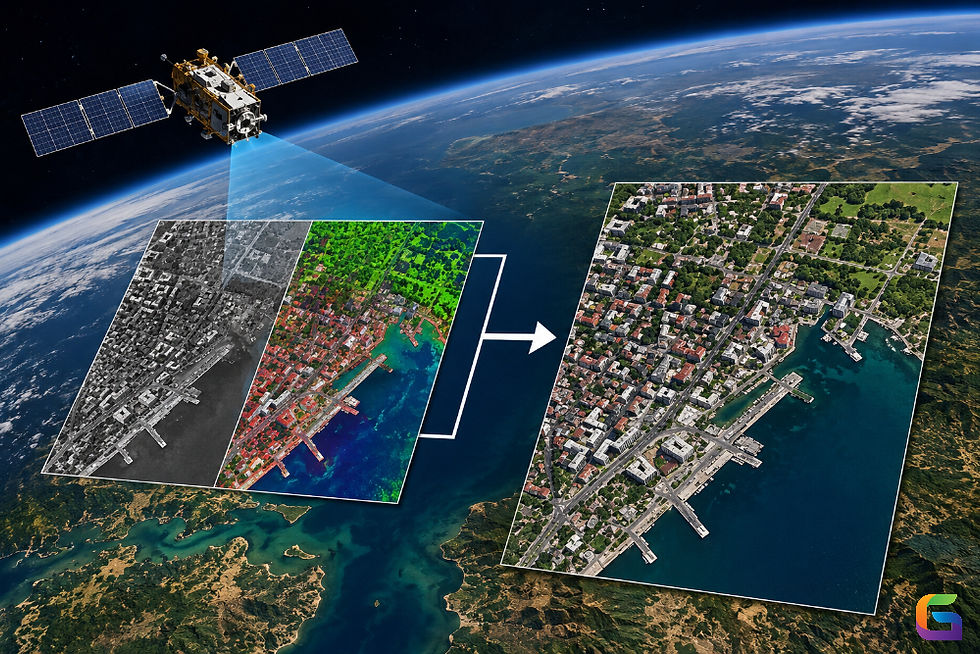
A 3D model of the Earth's surface that saves elevation data in a digital grid format is called a digital elevation model. An elevation value, typically expressed in meters, is contained in each pixel (or cell) in the grid, which represents a distinct spot on the Earth.
Terrain modelling, slope analysis, contour extraction, and surface process simulation are all made possible by DEM data. In contemporary geospatial processes, it serves as the basis for geographical analysis and 3D visualization.
Types of Digital Elevation Models
DEMs come in various forms, each with a distinct function:
Depicts the elevations of both natural and man-made elements, including bridges, buildings, and trees.
Beneficial for telecommunications network planning, line-of-sight studies, and urban planning.
Removes plants and artificial items to represent the raw dirt surface.
Extensively utilized in civil engineering projects, flood risk assessment, and hydrology.
Triangles are used to connect unevenly spaced points in a vector-based DEM representation.
Ideal for mining and engineering applications requiring accurate landscape modelling.
How are DEMs Generated?
There are various methods for creating digital elevation models, and each has a different level of precision and resolution:
Remote Sensing via Satellite
Global DEM datasets are provided by missions such as TanDEM-X, ASTER GDEM, and SRTM (Shuttle Radar Topography Mission).
For regional and continental studies, resolutions ranging from 30 to 90 meters are appropriate.
Light Detection and Ranging, or LiDAR
LiDAR, whether airborne or UAV-based, gathers extremely precise elevation data with a sub-meter precision.
Perfect for flood modelling, forestry, infrastructure planning, and precise mapping.
Drone or aerial imagery, or photogrammetry
DEMs are produced by applying photogrammetric methods to process overlapping aerial or UAV photos.
Economical for mapping agricultural, mining surveys, and construction monitoring.
Ground Surveying (Total Station & GNSS)
Offers extremely precise control points for localized models or DEM validation.
Advantages of Using DEMs
High level of detail and accuracy for terrain analysis.
Economical data collection with drones or satellites.
Allows for 3D simulation and visualization.
Makes it possible to integrate CAD and GIS systems.
Applicable in a variety of industries.
Challenges in DEM Usage
DEMs have drawbacks despite their benefits:
Resolution Dependency: Fine terrain details might not be captured by low-resolution DEMs.
Data Gaps & Errors: Accuracy may be impacted by vegetation, cloud cover, or radar shadows.
High Cost: For vast areas, LiDAR-based DEMs can be costly.
Processing Power: Robust computational resources are needed to handle high-resolution DEMs.
Popular DEM Datasets
SRTM DEM: Free worldwide coverage (30m/90m).
ASTER GDEM (30m) is a global optical sensor dataset.
Copernicus DEM: available for Europe at a resolution of 10m.
LiDAR DEMs: High-accuracy, localized datasets for engineering-level applications.
Future of Digital Elevation Models
The development of cloud-based geospatial platforms, AI-based terrain processing, and UAVs has made DEM creation more accurate, quicker, and less expensive. Future advancements will incorporate digital twins, IoT, and real-time elevation models for catastrophe resilience, smart city development, and climate adaptation planning.
For more information or any questions regarding the digital elevation model, please don't hesitate to contact us at
Email: info@geowgs84.com
USA (HQ): (720) 702–4849
India: 98260-76466 - Pradeep Shrivastava
Canada: (519) 590 9999
Mexico: 55 5941 3755
UK & Spain: +44 12358 56710


Comments