Case Study: Using Geospatial Intelligence for Infrastructure Asset Management (Utilities, Roads, Pipelines)
- Anvita Shrivastava

- Dec 10, 2025
- 5 min read
Updated: Apr 14
Infrastructure networks, such as electric utilities, transport corridors, and buried pipelines, span large geographical areas and are under increasing amounts of stress from ageing assets, changing regulations, climate change-associated risks, and growing consumer demand for services. As such, many organisations are now beginning to think about how best to operate and manage their critical infrastructure. To this end, geospatial intelligence (GEOINT) has emerged as an innovative capability for organisations operating in asset-intensive industries.
This case study focuses on how GEOINT technologies support operators in real-time monitoring, maintenance, and optimisation of utility and transport networks, as well as pipeline systems, via the use of data-driven insights.

What is Geospatial Intelligence?
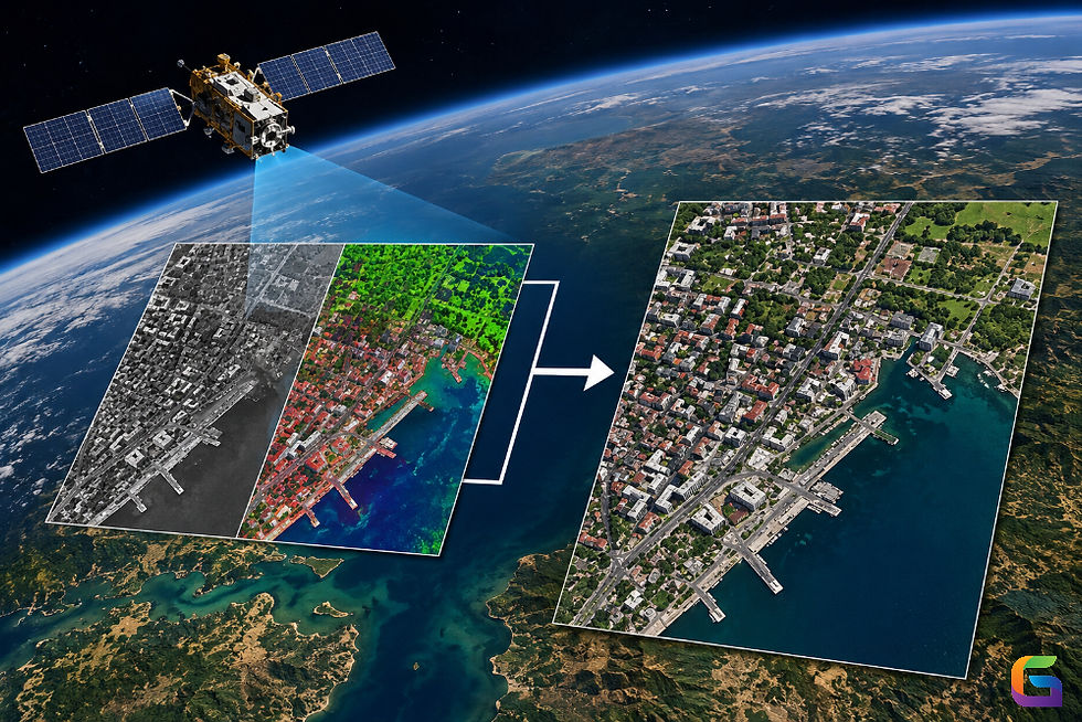
Geospatial Intelligence refers to the integration of Geographic Information Systems, Remote Sensing (satellite images), drones, and Artificial Intelligence capabilities to generate insights that provide location-based, real-time situational awareness. GEOINT provides a range of insights for utility, transport, and pipeline infrastructure operators, including:
Accurate situational awareness extending across broad and remote areas
Predictive maintenance via AI and climate-related data analysis
Immediate emergency response to outages/failures
Optimized operations and capital budgeting
Compliance with regulations via confirmed geospatial documentation
GEOINT allows companies to evolve from relying on static maps and manual inspections to creating a dynamic and continually monitored infrastructure environment.
Case Study Overview
An Infrastructure Authority, Responsible For Electric Distribution Assets, 500 Miles Of Highway And Critical Fuel Pipelines, Used Geospatial Technologies To Modernize How They Manage Their Assets, to minimize Asset Downtime, Maximizing Operational Efficiency And Reducing Risk Associated With Natural Hazards.
There Were Three Main Components Of The Program:
Utility Infrastructure (Electric Distribution Network)
Transportation (Road Networks)
Energy Pipelines (Fuel Transmission)
Each Component Utilized A Different Workflow And Analytical Approach For Geographic Information Systems.
Utilities: Modernizing Grid Management with GEOINT
Issue
Electric Distribution assets (poles, transformers, and conductors) were located in remote geographical locations. Inspections using traditional means performed poorly and cost too much, and as a result, resulted in:
Unexpected outages
Limited visibility of vegetation threatens the electric distribution system.
Long-time delays in evaluating storm damage.
Geospatial Intelligence Solution
Types of Data Sources Utilized
High-Resolution Satellite Images
LiDAR Scan From Drones and Manned Aircraft
Vegetation Index From Multispectral Images
Asset Registry Maintained Using GIS
Process Flow
Predict Vegetation Growth Management - Used AI models to analyze LiDAR Point Cloud Data to identify tree growth in proximity to energized conductors.
Analyzing Electric Grid Vulnerability - Combined Soil Moisture Data, Slope Analysis, and Historical Electric Outage Data to Produce Risk Heatmaps.
Storm Damage Model - Used Pre- and Post-Event Satellite Images to Evaluate the Condition of Affected Electric Assets Within Hours.
Results
Reduction of Vegetation-Related Outages on the Electric Distribution System by 35%
Reduced Inspection Costs Through the Use of Drone Inspections by 30%
Rapid Restoration of Electric Service Following Storm Damage with an Assessment Period from Several Days to Just Hours After the Event.
Roads: Intelligent Transportation Monitoring
Problem
The road authority needed a consistent and scalable method to monitor:
Pavement quality
Traffic patterns
Flooding and landslide risks
Asset inventories (signs, bridges, barriers)
Traditional ground surveys were slow, expensive, and inconsistent across districts.
Geospatial Intelligence Solution
Data Sources Used
Satellite imagery is refreshed every 5–10 days.
Mobile LiDAR from survey vehicles
UAV-based photogrammetry
Weather and hydrological data layers
GPS-based telematics from fleet vehicles
Key Workflows
Automated pavement condition scoring: Computer vision models detected cracking, rutting, and potholes.
Traffic congestion analysis: Integrated GPS and camera feeds into GIS-based flow models.
Hazard detection: Remote sensing identified areas with frequent flooding or slope instability.
Digital twin construction: A full 3D geospatial model of the roadway environment supported planning and maintenance.
Impact
20% reduction in pavement inspection costs
Optimized maintenance schedules based on real wear patterns
Faster hazard identification improves public safety.
Better capital planning, backed by detailed geospatial records
Pipelines: Enhancing Safety and Compliance
Challenges
The fuel pipeline network has been exposed to threats from third-party digging, rupture occurrences, land subsidence, and potential environmental risks. Thus, the operator needed to develop a system that would provide them with a proactive approach to monitoring compliance.
Geospatial Intelligence Solution
Data Sources Utilized
Synthetic Aperture Radar (SAR) satellite images are used to monitor millimeter-level ground movement.
Thermal Imagery is used to identify leaks.
Drone-based inspections are used to examine the corridors of pipelines.
Land Use Change Data.
Inline Inspection (ILI) data integrated into the Geographic Information System (GIS).
Major Workflows
Detection of infringements on the right of way: The automatic identification of construction that is unpermitted, excavating illegally, and/or heavy machinery on the right of way has been accomplished utilizing the Artificial Intelligence application.
Leak analytics: Thermal anomalies detected from aerial imagery have been used to correlate with sensor readings to provide additional evidence of a potential leak.
Monitoring Land Subsidence: SAR-based Interferometry has been used to identify movement of the ground along the Pipeline Corridor.
Regulatory Mapping: Compliance Reports and Spatial Records have been created automatically.
Results
Right-of-way detections have been completed in half the time.
Continued use of this technology will ultimately allow for the earliest detection of leaks, reducing the risk of an environmental impact.
Compliance with safety regulations improved, further limiting regulatory exposure.
Technical Architecture of the GEOINT Platform
Key Elements
Cloud-Based GIS (ArcGIS Enterprise, QGIS Server, PostGIS)
Remote Sensing Workflows (satellite, UAV, LiDAR)
AI/ML Analytical Frameworks (Python, TensorFlow, PyTorch)
Dashboards for Field and Management Operations
Spatial Data Lake Utilizing Cloud-Compatible Formats (Parquet, GeoParquet, Cloud Optimized GeoTIFF)
Highlights of Integration
Mobile GIS applications allow field crews to document updates in real-time.
AI detection generates alerts to associated personnel.
The creation of map services is automated following all data ingestion processes.
Workflows are integrated into existing work-order management systems (e.g., SAP, Maximo).
Key Learning Points
Establish a solid framework for data governance. The implementation of a clear, centralized, and well-structured geospatial dataset is critical.
Utilize a multi-sensory approach to gather information from more than one source. The use of multiple data sources leads to the best quality asset monitoring, so no one data source can provide a complete picture of your asset.
Ensure all designs enable automation of the process. The utilization of machine learning and continual monitoring of all processes creates a method for increasing the scalability of intelligence.
Invest in creating digital twins. A consolidated and GIS-supported Digital Twin can enhance planning and operations.
Use mobile GIS applications to provide field crews with continuously updated information from the field back into the GEOINT system.
GEOINT transforms how organizations collect and manage infrastructure assets, and it provides them with improved visibility, predictive capabilities, and efficiency. The examples provided demonstrated how utility, transportation, and pipeline organizations can realize substantial benefits when they use GEOINT, including: reduced outages, increased safety, decreased cost, ensuring compliance, and optimizing the use of available resources.
With the increased number of threats to the environment, economy, and infrastructure, GEOINT has transitioned from being optional to a critical foundational capability for the future generation of Infrastructure Systems that will be resilient and sustainable.
For more information or any questions regarding the geospatial intelligence, please don't hesitate to contact us at
Email: info@geowgs84.com
USA (HQ): (720) 702–4849
India: 98260-76466 - Pradeep Shrivastava
Canada: (519) 590 9999
Mexico: 55 5941 3755
UK & Spain: +44 12358 56710


Comments