The Role of Geospatial Analytics in Urban Planning and Smart Cities
- Anvita Shrivastava

- Dec 8, 2025
- 4 min read
Updated: Apr 14
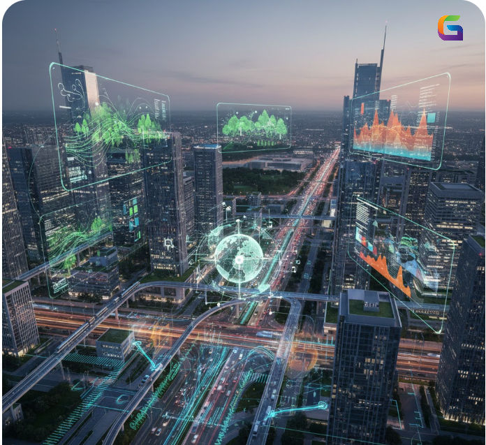
In today’s rapidly urbanizing world, cities are looking for smarter, data-driven ways to manage growth, infrastructure, and public services. Geospatial analytics—the practice of analyzing geographic and location-based data—has become a cornerstone of modern urban planning and the development of smart cities. By combining GIS (Geographic Information Systems), remote sensing, real-time sensor networks, and predictive analytics, urban planners can visualize trends, optimize resource allocation, and create more sustainable and resilient communities.
What Is Geospatial Analytics
Geospatial Analytics involves collecting, processing, and the analysis of location-specific data. These types of analysis utilize many technologies for data collection and entry, and provide significant insights to municipal leaders about how people interact with the existing infrastructure and what areas need infrastructure improvements.
Sources of Geospatial Data
Municipal Vector Data Networks
Real-Time Traffic Systems
The data from each of these sources provides valuable insight for city officials to better understand how citizens travel and use their infrastructure, and what areas need improvement.
Why Geospatial Analytics Matters in Urban Planning
More Efficient Use of Land Resources
Urban planners use geospatial tools to map zoning boundaries, analyze land suitability, and predict future growth patterns. These insights help:
Identify ideal locations for housing, commercial areas, and green spaces.
Prevent urban sprawl
Protect environmentally sensitive regions.
GIS-based simulations allow planners to test multiple development scenarios before making final decisions.
Creating More Sustainable Development Approaches
Geospatial analytics will help urban planners with their transportation, water supply, wastewater, solid waste management, and energy infrastructure. Geospatial analytics will provide planners with a clear visual representation of demand patterns, as well as potential weaknesses within the existing infrastructure. As a result, cities can prioritize upgrading current infrastructure while also avoiding or minimizing unnecessary costs associated with long-term infrastructure use.
Enhanced Transportation and Mobility Planning
Transportation enhancement and development of Mobility have become easier with Real-time Digital Geo-Spatial Data - it allows for more effective and efficient management of urban Mobility. For example, this technology allows for:
Traffic congestion assessment
Route optimisation of public transit systems
Mapping of autonomous vehicle routes
Micro-mobility planning (E-scooters, Bicycles, etc...)
Predictive analytics allow for cities to foresee the traffic surge and use Traffic Management strategies proactively.
Environmental Monitoring and Sustainability
Using geo-spatial analytics provides a way for cities to conduct Climate resilience planning. Cities can monitor:
Air Quality
Urban Heat Islands
Flood Zones
Water Quality
Plant Health
Remote Sensing (drone) technology supports environmental sustainability, allowing policymakers to be able to monitor, evaluate, and react to environmental changes.
Emergency Response and Disaster Management
In a Crisis, having location-based data is critical. Geo-spatial mapping allows Emergency Management Agencies:
To identify who is at risk
To find the most efficient route for evacuation
To create maps of current hazards (Floods, Fires, Storms)
To deploy Emergency Services effectively
Fast, data-driven decisions can save lives and minimize damage.
Citizen Participation and Enhanced City Services
Geospatial dashboards are used in many smart-city systems that help residents:
Track and monitor residents' construction projects.
Check transportation schedules
Analyze trends within their neighborhoods.
Report on neighborhood problems (e.g., potholes, light outages)
Communicating with the public develops citizens' trust in government activities, increasing their involvement in local government decision-making processes.
How Geospatial Analytics Powers Smart Cities
Smart cities depend on data connectivity. Geospatial systems act as the central intelligence layer for:
AI-driven predictions
Real-time visualization dashboards
Digital twins of cities
A digital twin replicates the urban environment, allowing planners to simulate upgrades, test disaster scenarios, and improve service delivery.
With geospatial analytics, cities become more adaptive, efficient, and responsive to citizens’ needs.
Key Technologies Driving Geospatial Innovation
GIS (Geographic Information Systems)
The backbone of mapping and spatial analysis.
Remote Sensing
Satellite and drone imagery for environmental and infrastructure monitoring.
Artificial Intelligence and Machine Learning
Predictive models for traffic flow, energy demand, and disaster forecasting.
Cloud Computing and Edge Computing
Scalable platforms for storing and processing large spatial datasets.
Future Trends: What’s Next for Geospatial Analytics?
Digital twins that support dynamic modeling of a city's evolution over time.
The use of fifth-generation cellular technology (5G) enables hyper-accurate real-time tracking.
The deployment of AI-enhanced autonomous systems for public transport.
The development of algorithms designed to forecast climate risks and promote a city’s overall resilience over time through thoughtful city planning.
Citizen-centric smart services that use APIs and geospatial data.
As technology continues to advance at an unprecedented pace, geospatial analytics will continue to play an integral role in the development of tomorrow’s urban environments.
Geospatial analytics has become a crucial tool for creating urban areas that are efficient, sustainable, and intelligent. Whether it's through mobility planning or tracking your local environment, city leaders need the capability to evaluate data by location to support informed decisions that will improve the quality of life and increase economic development benefits to all people who inhabit a community.
As smart cities continue to grow around the world, geospatial intelligence will continue to serve as the platform for new developments in urban planning.
For more information or any questions regarding the geospatial analytics, please don't hesitate to contact us at
Email: info@geowgs84.com
USA (HQ): (720) 702–4849
India: 98260-76466 - Pradeep Shrivastava
Canada: (519) 590 9999
Mexico: 55 5941 3755
UK & Spain: +44 12358 56710


Comments