JPEG 2000 (JPEG 2K) in GIS: Advanced Image Compression for Remote Sensing
- Anvita Shrivastava

- Oct 1, 2025
- 4 min read
Updated: Oct 2, 2025
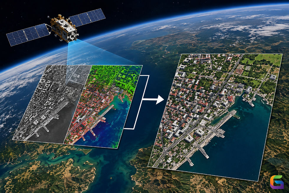
JPEG 2000 (often referred to as JPEG 2K or JP2) is an image coding system created by the Joint Photographic Experts Group (JPEG) as a successor to JPEG. JPEG 2000 uses wavelet compression technology rather than the DCT compression employed by JPEG. Compression can be applied with or without loss of information in the same coding scheme. This flexibility in compressing images with an emphasis on either image quality or file size is appealing for use in remote sensing, where the conflict between information density and file size is key.

Why JPEG 2000 Matters in GIS and Remote Sensing
High-resolution satellite and aerial imagery typically ranges from gigabytes to terabytes. Efficiently managing, transferring, and analyzing these datasets necessitates advanced compression techniques. JPEG 2000 provides several benefits when used with GIS:
Better Compression Efficiency
Provides a higher compression ratio with reduced visual quality loss compared to traditional JPEG.
Offers support for lossless compression (for scientific fidelity) and lossy compression (for visualization and storage).
Progressive Transmission
Allows users to access imagery with varying degrees of fidelity without having to download the entire files.
Ideal for web-based GIS when bandwidth is a concern.
Encoding Regions of Interest (ROI)
Supports selective decompression of geographic areas.
Useful in remote sensing applications where analysts use large datasets to examine specific areas.
Support for Scalable and Multi-Resolution Images
You can store images in a single file with multiple resolutions.
This provides seamless zooming and panning capabilities within the GIS software without the need for separate pyramid layers.
Error Recovery and Streaming Support
Built-in error correction allows partial recovery of data during transmission.
Supports streaming, enabling faster access to remote datasets.
Applications of JPEG 2000 in Remote Sensing and GIS
JPEG 2000 is progressively being embedded within geospatial technologies and supported by many GIS platforms such as Esri ArcGIS, QGIS, and GDAL. Applications of JPEG 2000 are becoming more common, and include:
Storing satellite imagery: Multispectral and hyperspectral images, which benefit from efficient compression.
Portals in a web-based GIS: Providing imagery access to the end-user progressively.
Disaster management: Providing field teams with high-resolution imagery.
Defense and intelligence: Transmitting very large, sensitive datasets to units with lossless integrity.
Archiving: Storing many images with lower file data while maintaining data quality.
Disadvantages of JPEG 2000
Performance Overhead
Compared to MrSID or even regular JPEG, encoding and decoding are computationally demanding, meaning they require additional CPU and memory.
Slower Random Access
While it does support tiling, partial image retrieval (like zooming into a small section of a large image) is slower than MrSID—it is simply not as valuable in a GIS workflow.
File Size Efficiency
The compression ratio is typically lower than MrSID when working with very large satellite or aerial imagery, meaning the files can still be fairly large.
Limited GIS Optimization
Though it has been designed to be a more general image format, JPEG 2000 does not support specialized multi-resolution pyramids like MrSID, and that makes it quite slow for use in geospatial platforms.
Software Support Gaps
Although JPEG 2000 has been recognized as an ISO standard, there are many inconsistencies in support across GIS-type tools. Some tools only support partial JP2-related metadata, projections, or tiling.
Interoperability Issues
There are interoperability issues when using different implementations of JPEG 2000 (JP2, JPX, GMLJP2), and those differences often cause compatibility problems between systems.
Not Ideal for Very Large Datasets
Performance with multi-gigabyte geospatial imagery is often inconsistent. As with MrSID, when rendering and streaming, image performance is poorer.
Adoption in the Geospatial Field
Despite being standardized, JPEG 2000 never became the dominant image format in GIS because users struggled with performance issues and preferred alternate formats and solutions that ultimately provided better results, such as MrSID and Cloud-Optimized GeoTIFF (COG).
Future of JPEG 2000 in Geospatial Technology
As the resolution and volume of remote sensing data continue to increase (for example, next-generation satellites are producing imagery at a petabyte scale), compression standards like MrSID and JPEG 2000 are likely to remain essential. Other options like Cloud Optimized GeoTIFF (COG) and BigTIFF are becoming more popular, but JPEG 2000 is likely to maintain its importance in many GIS workflows because of its unique features like ROI access and multi-resolution capabilities.
Comparison Between MrSID and JPEG 2000
Feature | MrSID (Multi-resolution Seamless Image Database) | JPEG 2000 (JP2) |
Compression Algorithm | Proprietary wavelet-based (LizardTech/Extensis) | Wavelet-based (ISO Standard) |
Compression Ratio | High (10:1–20:1 typical, sometimes more) | Moderate (up to 10:1 typical) |
Lossless Support | ✅ Yes | ✅ Yes |
Lossy Support | ✅ Yes | ✅ Yes |
Multi-resolution Access | ✅ Seamless zoom, highly optimized | ⚠️ Supported but slower in GIS |
Random Tile Access | ✅ Very fast partial retrieval | ⚠️ Supported, but less efficient |
Storage Efficiency | ✅ Excellent for large datasets | ⚠️ Less efficient with very high-res imagery |
Rendering Performance | ✅ Optimized for fast GIS visualization | ⚠️ Can be slower on large datasets |
Dataset Size Handling | ✅ Handles multi-GB imagery efficiently | ⚠️ Struggles with very large files |
Software Support | ✅ Widely supported (ArcGIS, QGIS, ERDAS, etc.) | ⚠️ Supported, but less consistent across GIS tools |
Standardization | Proprietary format | Open standard (ISO/IEC 15444) |
Best Use Case | Large satellite imagery, aerial photography, GIS workflows | Archival, general imaging, interoperability |
For more information or any questions regarding JPEG 2000, please don't hesitate to contact us at
Email: info@geowgs84.com
USA (HQ): (720) 702–4849
India: 98260-76466 - Pradeep Shrivastava
Canada: (519) 590 9999
Mexico: 55 5941 3755
UK & Spain: +44 12358 56710

Comments