
Understanding World Files in GIS and Georeferenced Imagery

Updated: May 31
Geographic Information Systems (GIS) rely heavily on georeferenced imagery for their primary applications of mapping, spatial analysis, remote sensing, and cartography. Accurately positioning images on the Earth's surface is critical, regardless of the type of image you are using (aerial imagery, scanned maps, drone orthophotos, or satellite imagery). The easiest way to accomplish this task is by using a world file.
If you have ever opened a file ending with the extensions of .tfw, .jgw, .pgw, or .wld, then you have worked with a world file without even realizing it!
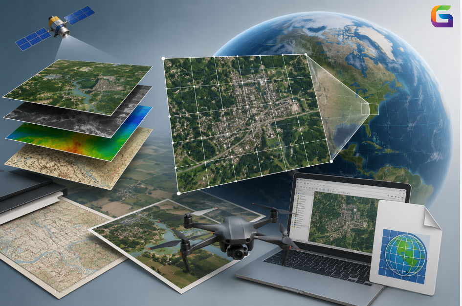
What is a World File?
Essentially, World files are simple textual (plain text) documents that contain geographical information to help place raster images on a real-world coordinate system or coordinate system (e.g., maps) without adding spatial metadata directly to the raster. Raster formats for which it is common to find world files include:
TIFF
JPEG
PNG
BMP
GIF
The raster file contains only pixel values, and in order to place the raster onto a map correctly, world files are needed to provide the spatial reference.
Why World Files Matter in GIS
When a raster image is not georeferenced, it is nothing more than a bunch of pixels sitting next to one another with no significance to their location on the earth. Without georeferencing, there is no way for a GIS product to know:
Where on Earth does the image reside
What scale to use for this image
The size of each pixel in map units
How is the image orientation related to North?
A world file solves this issue by providing the mathematical relationships between the image's pixels and the earth coordinate system.
The world file is extremely helpful because it can be used with:
The digitization of historical maps,
Digital orthomosaics produced by UAVs,
Scanned engineering drawings,
CAD overlays, and
Web mapping programs.
Example of a Complete World File
0.50.00.0-0.5500000.04200000.0This tells GIS software:
Each pixel is 0.5 units wide.
Each pixel is 0.5 units tall.
The image is not rotated.
The image starts at the specified coordinate.
Mathematical Transformation Behind World Files
The coordinate transformation can be represented as:
Xmap=A⋅x+B⋅y+CYmap=D⋅x+E⋅y+F\begin{aligned}X_{map} &= A\cdot x + B\cdot y + C \\ Y_{map} &= D\cdot x + E\cdot y + F\end{aligned}XmapYmap=A⋅x+B⋅y+C=D⋅x+E⋅y+F
Where:
x,yx, yx,y are pixel coordinates
Xmap,YmapX_{map}, Y_{map}Xmap,Ymap are real-world coordinates
A, B, C, D, E, FA, B, C, D, E, FA, B, C, D, E, F are world file parameters.
This affine transformation allows GIS software to accurately place raster imagery.
Common World File Extensions
Different raster formats use different world file extensions.
Raster Format | World File Extension |
TIFF | .tfw |
JPEG | .jgw |
PNG | .pgw |
BMP | .bpw |
GIF | .gfw |
Some applications also use the generic:
.wldextension.
Advantages of World Files
Simple and light-weight
World files are small text documents that are easy for both creation and editing purposes.
Software compatibility
A wide range of GIS applications are compatible with World Files, including:
ArcGIS
Global Mapper
ERDAS Imagine
AutoCAD Map 3D
Manual Editing
Since they are written in plain text, users can easily edit the coordinate values or adjust the size of a pixel.
Disadvantages of World Files
No projection information
To create a proper projection, separate Common Reference System (CRS) definitions must be established.
Limited support for transformations
World files only support affine transformation and do not support rubber sheeting, complex warps, or terrain corrections.
Reliance on a companion raster
If the filename of the raster that the world file points to has been changed, the world file may not work correctly anymore.
World Files are foundational to raster georeferencing within Geographic Information Systems ("GIS"). They offer a straightforward but effective means of accurately placing images in relation to their actual position on the Earth’s surface.
By comprehending the operation of World Files, GIS professionals can troubleshoot problems with the alignment of raster data, refine geospatial workflow, and manage raster images and data more efficiently.
Mastering World Files is an important skill for anyone involved with either Drone Imagery, Scanned Cartographic Maps or Satellite Data.
For more information or any questions regarding world files, please don't hesitate to contact us at
Email: info@geowgs84.com
USA (HQ): (720) 702–4849
India: 98260-76466 - Pradeep Shrivastava
Canada: (519) 590 9999
Mexico: 55 5941 3755
UK & Spain: +44 12358 56710


Comments