What is Considered a High-Resolution Image?
- Anvita Shrivastava
- Aug 21, 2025
- 2 min read
Imagery is essential to precise mapping, geographical analysis, and decision-making in Geographic Information Systems (GIS). The degree of information that a picture offers is referred to as its "resolution," and choosing the appropriate data for your GIS project requires a grasp of the various resolution categories.
Understanding Image Resolution in GIS
The size of a single pixel on the ground is known as spatial resolution, or image resolution. Larger pixels offer a wider perspective, while smaller pixels capture more detail. Four broad categories are used to classify GIS images based on spatial resolution:
Very High Resolution (VHR)
Size of Pixels: 1 cm to 1 m
Sources include high-end satellites (such as WorldView-3, 21AT, and Albedo), drone imagery, and aerial imagery (such as Hexagon and Vexcel).
Features: Exceptionally detailed objects, like miniature cars, street furniture, utility poles, and individual plants
Applications include catastrophe monitoring, 3D modelling, urban infrastructure mapping, and precision agriculture.
For example, drone surveys that record 2–5 cm per pixel for in-depth site mapping
High Resolution (HR)
Pixel Dimensions: 1 m to 5 m
High-resolution satellites (Pleiades, GeoEye-1) are the source.
Features: Visible buildings, roads, water features, and vegetation patterns
Applications include disaster assessment, environmental monitoring, and urban planning.
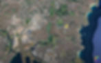
Medium Resolution (MR)
Pixel Dimensions: 5–30 m
Source: Landsat 8 and Sentinel-2, two satellites with a moderate resolution
Features include city blocks, farms, lakes, forests, and a variety of large land uses.
Applications include mapping land cover, forestry management, and regional planning.
Low Resolution (LR)
Pixel Size: at least 30 m to 1 kilometre
Source: MODIS and other coarse-resolution satellites
Features: Broad trends like ocean currents, climate zones, and vegetation worldwide
Applications include worldwide mapping, environmental trend analysis, and climate monitoring.
Drone Imagery: Redefining Very High Resolution
Drones produce very high-resolution (VHR) photography with pixel sizes as small as a few centimetres, whilst satellites provide high-resolution data. This degree of specificity allows:
Precision Mapping: Exceptionally accurate detection of minute features
3D Modelling: Producing precise building and terrain models
Rapid Assessment: Fast surveys for disaster monitoring, construction, or agriculture
Compared to conventional high-resolution satellite data, drone imaging offers extraordinary detail, versatility, and cost-effectiveness, making it especially transformational for GIS.
Applications Across Resolution Categories
Different resolutions are needed for various GIS projects:
VHR & HR: Infrastructure monitoring, precision farming, and urban planning
MR: Watershed mapping, forestry, and regional land cover studies
LR: Global-scale analysis, environmental trend monitoring, and climate change research
The accuracy and usability of spatial data in GIS are directly impacted by the picture resolution selection.
Accurate mapping, efficient analysis, and well-informed decision-making are ensured by choosing the appropriate resolution. GIS experts may now record previously unheard-of detail for highly specialised applications because of drones' ability to provide extremely high-resolution photography.
For more information or any questions regarding high-resolution images, please don't hesitate to contact us at
Email: info@geowgs84.com
USA (HQ): (720) 702–4849
India: 98260-76466 - Pradeep Shrivastava
Canada: (519) 590 9999
Mexico: 55 5941 3755
UK & Spain: +44 12358 56710