
What Is Satellite Tasking and How Does It Work?

The introduction of satellite imagery has become important in various fields today, such as remote sensing, Geographic Information Systems (GIS), environmental monitoring, urban planning, agriculture, disaster management, and infrastructural development. However, not all satellite images are taken automatically or are available in the existing imagery archive. In certain cases, satellite operators are required to take images of specific locations at specific times. This operation is termed satellite tasking.
Satellite tasking refers to the process through which requests for new satellite images are made based on the area of interest (AOI), date of acquisition, imaging requirements, and other technical parameters. The satellite operators use these requirements to schedule and use the satellite sensors in such a way that the requested geographic area can be captured.
Due to the constant need for high-resolution satellite imagery and urgent geospatial information, satellite tasking is seen as a vital service for commercial Earth observation.

What Is Satellite Tasking?
Satellite tasking refers to the act of requesting that a satellite operator gather new photography of a certain geographic location according to predetermined specifications. Rather than choosing a current image out of a collection of historical imagery, a user would file a request for imaging to an Earth observation satellite, telling it to document data in the desired area.
A standard satellite tasking request consists of:
Area of Interest (AOI): The geographical area or boundary the satellite should cover.
Acquisition Date: The date or time period the images are to be taken.
Spatial Resolution: The amount of required ground detail, e.g., 30 cm, 50 cm, or 1 meter.
Spectral Requirements: The type of imaging band required (panchromatic, multispectral, hyperspectral, etc.)
Cloud Cover Threshold: The maximum level of cloud coverage permissible in the area of the target.
Imaging Angle: The angle at which the satellite is expected to photograph the target.
Priority Level. The urgency of the imaging request.
Once requests are received by the satellite operator, he/she has to assess the demands of the satellite tasking, probe for satellite availability, and ascertain the possibility of the instructed acquisition.
How Does Satellite Tasking Work?
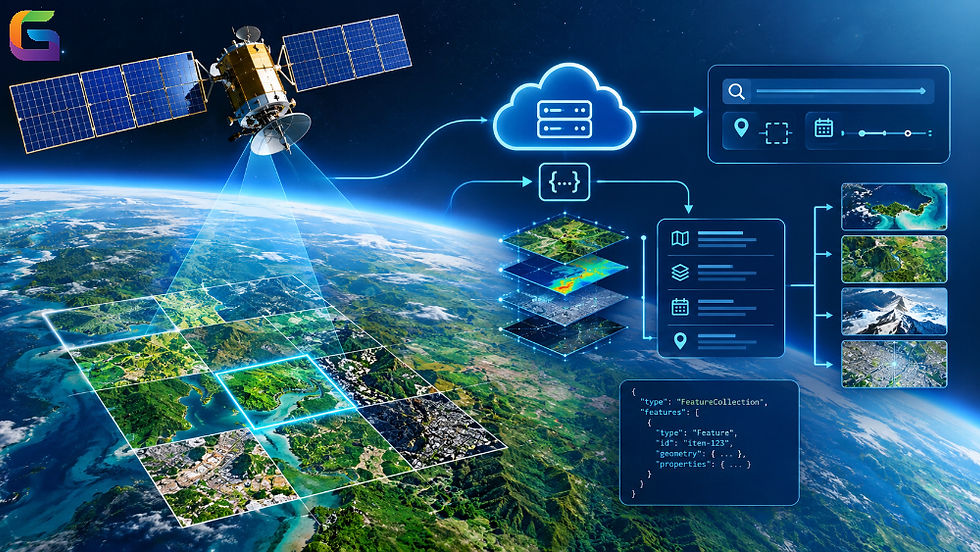
Satellite tasking refers to the technical and operational processes used during satellite imagery acquisition and final delivery of the images to the client.
Define the Area of Interest (AOI)
The first step of satellite imagery acquisition consists of defining the desired area of interest. The user can specify the issue site through geographical coordinates, polygon, bounding box, or GIS file upload.
Some common formats for defining the area of interest include:
WKT (Well-Known Text)
Geographic coordinates (latitude and longitude)
By determining the area of interest, satellite operators can foresee the required area coverage and find the potential passes of the satellite.
Specify Imaging Requirements
Following the identification of the AOI, the user will specify their technical requirements. These requirements will determine the satellite and sensor with the appropriate features for the task.
Key parameters include:
Spatial Resolution: Determines the smallest ground object that may be resolved in the image. A higher resolution is required if it is necessary to monitor infrastructure, identify buildings, or create a detailed map.
Spectral Resolution: Identifies the capacity of the sensor to collect information in different wavelengths. For example, multispectral imagery enables vegetation studies, detection of water bodies, and mapping of land use types.
Temporal Requirements: Indicate when the satellite must take images of the area of interest. In some cases, imagery must be obtained during a specific time frame, while in others, imagery needs to be captured twice.
Cloud Cover: Indicates the total number of clouds permitted in an image. In most cases, cloud cover is supposed to be low.
Off-Nadir Angle: Indicates the angle between the satellite’s line of sight and the vertical direction under the satellite. This angle influences image configuration, area of coverage, and possibilities for obtaining images.
Satellite Selection and Feasibility Analysis
When the application forms are completed, the satellite operator makes a decision on which satellite can fulfill the request.
Several technical aspects are taken into account:
Orbital features and frequency of revisits.
Sensor details and capabilities.
Ability to point the satellite
Available memory.
Imaging capabilities versus possible scheduling conflicts.
Atmospheric conditions for optical imagery.
Atmospheric conditions such as the weather.
The operator will determine whether the satellite is capable of capturing the area during the next orbital missions.
It should be noted that one satellite cannot capture any requested location all the time, but this capability depends on orbital geometry, sensor properties, and existing limitations.
Task Scheduling and Satellite Programming
Following the feasibility assessment, the operator proceeds to schedule the imaging request.
The satellite tasking system prepares the acquisition plan based on several factors, including the satellite's orbital position, location of the target, sensor orientation, and the availability of time for imaging.
The satellite receives the necessary commands from the ground control station or with the help of satellite communication systems.
The commands include:
Meaning of the target location and boundaries of imaging.
Start and end times of acquisition.
Sensor setup.
Instructions for satellite pointing.
Parameters for collecting the data.
The scheduling system also takes into account other imaging requests to effectively use the satellite and avoid conflicts.
Image Acquisition
Once the satellite orbits in its designated position, the imaging sensor collects the required images of the geographical region.
The remote sensing technologies of satellites can be classified into different types according to the type of sensors used.
Optical Sensors: Optical sensors are those that capture the reflected sunlight in the visible and infrared spectrum. This technology is typically used for land-use mapping, agriculture, urban development, and environmental monitoring.
Synthetic Aperture Radar (SAR) is a remote sensing technology that uses microwave signals to gather information regarding the Earth's surface. Satellites of this type can take images both day and night, and they are usually able to collect information even through clouds.
Multispectral Sensors: The multispectral sensors collect information over several spectral bands, which could be used in analyzing vegetation, assessing water quality, and land-cover classification.
The information obtained is temporarily stored on board before being transmitted to the ground receiving station.
Data Downlink and Processing
Once the image is taken, the information collected by the satellite is sent to the ground station when the satellite finds a communication window.
The information received is processed through the steps below:
Radiometric correction,
Geometric correction,
Orthorectification,
Atmospheric correction,
Image calibration,
Cloud detection and quality analysis,
Image mosaicking, if needed.
The actual process that is followed depends on the satellite sensor, product level, and requirements from the customer.
For example, orthorectification removes distortions caused by the height(s) of the area, satellite location, and geometry of the sensor placement.
Image Delivery
The last step involves delivering processed satellite images to the client.
Depending on the service provider, the satellite images can be received via cloud storage, through an API, an online image platform, or via direct download.
The most common formats of delivery are:
Cloud Optimized GeoTIFF (COG).
JPEG2000.
NITF.
Other raster formats specific to the provider.
The client can further use the images with GIS software and remote sensing applications and in geospatial analysis procedures.
Types of Satellite Tasking
Satellite Tasking can be defined based on its urgency to acquire an image, the need for a scheduling process, and the frequency of imaging.
Standard Satellite Tasking
Standard tasking involves the scheduling of a new satellite image acquisition in a pre-defined timeframe.
In this case, users define their area of interest and imaging parameters, while the satellite operator schedules the task depending on the satellite’s availability.
This type is well-suited for:
Monitoring of urban development
Agricultural evaluations
Mapping Infrastructure
Land-use and land-cover assessments
Priority Satellite Tasking
Priority tasking is employed when images should be captured in a shorter timeframe.
Satellite operators may prioritize the acquisition request and the satellite availability based on their capacity to meet operational requirements and, hence, the terms of a service agreement.
This type is suitable for:
Planning of emergency response
Assessment of damages caused to infrastructure
Monitoring natural hazards
Conducting time-sensitive environmental investigations.
Monitoring or Recurring Tasking
Repeated satellite tasking entails scheduling several acquisitions of similar geographic sites over a pre-established duration.
This method enables customers to follow alterations over time so that different images can be compared.
Examples of use:
Monitoring of construction processes.
Evaluation of crop growth.
Identification of deforestation.
Following activities in mining.
Studying coastal erosion.
Using Constellation Tasking
Constellation tasking utilizes several Earth observation satellites in order to provide more acquisition opportunities and better revisit rates.
A satellite constellation is a formation of various satellites that could offer more frequent imaging than one satellite, depending on sensor capabilities and orbit type.
This method can be an asset in the case that a project requires frequent observations in a vast area or in a geographically distributed area.
Advantages of Satellite Tasking
Satellite tasking has numerous benefits for businesses in need of innovative and tailored Earth observation data.
Localized Image: Users can order imagery of a certain area rather than relying entirely on archival material.
Enhanced Relevant Data: The fresh imagery yields recent observations when old data is not enough.
Customized Imaging Needs: Users can refer to the satellite’s options and require particular resolution, spectral bands, % of cloud cover, time of acquisition, etc.
Consistent Monitoring: By recurring the same acquisition, geographic changes can be observed over a certain time period.
Use of Proficient Sensors: Tasking allows users to choose the proper optical, multispectral, or SAR sensor, depending on the project needs
Enhanced Decision-Making: The recent images provide necessary data for GIS analysis, infrastructure planning, environmental assessment, and resource management.
Challenges and Limitations of Satellite Tasking
While satellite tasking provides adaptability in operations, different considerations could influence the receiving and collection of data.
Availability of Satellites
The availability of a satellite relies on orbital passes, the functionalities of sensors, and existing requests for imaging. On the date required, a satellite may not provide imaging of the target site.
Weather Conditions
Optical satellite sensors use sunlight reflection; hence, they are impacted by clouds, mist, and environmental conditions. In order to obtain cloud-free imagery, additional acquisition sessions might have to take place.
Cost of Acquisitions
The cost of new satellite acquisition can vary depending on spatial resolution and size of the AOI, and on the types of satellites used.
Frequency of Revisit
The revisit frequency describes how frequently a satellite can gather data from a specific area. Though satellite configurations can help acquire more images, one cannot be certain of a high acquisition frequency.
Image Processing and Delivery Time
Satellite images must go through processing and quality checks before being delivered, with the amount of time needed depending on data volume, complexity of processing, availability of ground stations, and the workflow of the provider used.
Viewing Geometry
Satellite viewing angles can influence image quality and geometric accuracy. Large off-nadir angles may introduce distortions, particularly in areas with tall buildings or complex terrain.
The Role of Satellite Tasking in Modern GIS and Remote Sensing
In response to a growing need for up-to-date specialized geospatial information, satellite tasking is becoming increasingly prominent.
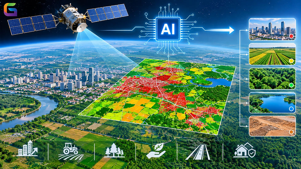
Nowadays, GIS processes incorporate a combination of satellite footage obtained through tasking and pictures captured in the past, along with DEM, vector representation, LiDAR technology, and AI systems.
In one example, GIS specialists may process current satellite coverage along with older information to determine how land cover has changed, how infrastructure has emerged, or whether any environmental disturbances have happened.
Cloud-based geospatial solutions make it simpler to store, analyze, and visualize satellite images regardless of the limitations imposed by local computing.
Advancements in remote sensing will enable satellite tasking to provide regular appraisal, planning, and data processing in the near future as well.
The process of satellite tasking is essential for obtaining Earth observation data, as it enables users to solicit a new satellite image based on their geographical location and specifications. The process involves various steps, starting from the definition of an area of interest to the selection of appropriate sensors, the satellite operation schedule, and acquisition of the photograph.
The areas of application include agriculture, urban planning, disaster management, mining, environmental monitoring, and infrastructure construction.
Combining satellite tasking with GIS, remote sensing, cloud image hosting, and AI analytics helps organizations secure more comprehensive geospatial data and make sufficiently informed decisions.
When obtaining earth observation data with hourly satellite images of the area of interest is necessary, satellite tasking is a useful option.
For more information or any questions regarding Satellite Tasking, please don't hesitate to contact us at
Email: info@geowgs84.com
USA (HQ): (720) 702–4849
India: 98260-76466 - Pradeep Shrivastava
Canada: (519) 590 9999
Mexico: 55 5941 3755
UK & Spain: +44 12358 56710

Comments