
World Space Week 2026: Exploring Space and Technology

World Space Week 2026 runs from 4 to 10 October and aims to bring global attention to space exploration, satellite technology, innovation, and the growing impact of space-based data on life on Earth. The theme for this year is “Rocket Revolution,” which highlights how quickly launch technology and the space economy are growing.
The increasing number of commercial satellites and spacecraft in orbit is increasing the importance of satellite data far beyond scientific research in space. Today, information sourced from satellites assists in navigation, logistics, aviation, environmental observation, disaster response, telecommunications, mapping, and autonomous systems.
However, satellite deployment is only one component of the new space data ecosystem. Making observations from space into correct and usable information is a process that requires reliable geospatial reference systems.

What Is World Space Week?
World Space Week is an international event that is celebrated every year from October 4 to October 10. The purpose of these dates is to celebrate two important achievements in the field of space exploration: launching Sputnik 1 on October 4, 1957, and signing the Outer Space Treaty on October 10, 1967.
This week is a good time to recognize the importance of space science and its technologies for society, as well as providing opportunities to inspire interest in education and innovations.
In 2026, the theme of the week is “Rocket Revolution,” symbolizing the significant changes and innovations in the area of space, specifically in technologies such as reusable launch systems, commercial satellite constellations, and small satellites, advanced Earth observation systems, and modern services related to space.
The Rocket Revolution Is Creating More Geospatial Data
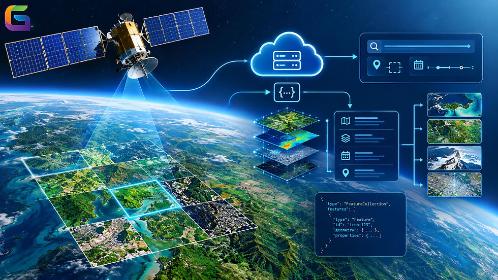
The rise of commercial space technology generates an incredible amount of Earth observation and geolocation data. Advanced satellite constellations make it possible to obtain images and measurements that have better spatial, spectral, and temporal resolution.
This data represents a relevant input in:
Satellite imagery and Earth observation
Global positioning and navigation
Transport and logistics
Aviation route planning
Precision agriculture
Urban and infrastructure monitoring
Disaster response and emergency management
Climate change and environmental monitoring
Defense and security
Autonomous vehicles and robotics
Maritime monitoring
Mapping and geospatial analytics
Thus, the challenge is no longer only to collect satellite data but also to ensure its proper processing and organization, referencing and analysis, and its proper integration.
Connecting Satellites, GPS, and GIS
One of the most important links between the space industry and geospatial technology is the relationship between GNSS, WGS84, and GIS.
Global Navigation Satellite Systems (GNSS) enable the determination of position based on signals transmitted from satellites. WGS84 supplies a global geodetic framework that is predominantly used with GPS.
Later, the GIS platform can use these coordinates to visualize, analyze, and combine geographic information.
This leads to the emergence of an excellent process:
Satellite systems → Positioning → Coordinate reference systems → Geospatial data → GIS analysis → Application in the real world.
Without precise spatial referencing, it’s impossible to use even the highest-definition satellite images without experiencing difficulties in integrating them with other databases.
From Orbit to Autonomous Systems
The revolution in rocketry affects not only conventional space images. Now, satellites are increasingly used in connection with Earth observation data in autonomous and smart systems.
We can state with certainty that autonomous vehicles and drones, robotics, shipping, and logistics systems will definitely use the positioning data obtained from satellites.
It is clear that accurate positioning is extremely important for the new generation of autonomous tools.
A self-driving vehicle, drone, airplane, or robot should be aware not only of its own location but also of the location of roads, buildings, land, protected zones, infrastructure, and other geographic features.
The Growing Role of Geospatial Platforms
As satellite networks evolve within the current technological era, companies require advanced solutions for utilizing geospatial information properly.
Modern geospatial platforms are built to manage procedures with:
Aerial photographs and images from drones
LiDAR data
Vector data
Cloud-based geospatial processing
Spatial analysis
GeoAI and machine learning
Platforms like GeoWGS84.com gain access to satellite and aerial photography, as well as geospatial technologies required for the development of mapping, remote sensing, GIS, and spatial analysis solutions.
The broader ecosystem of GeoWGS84.com is focused on the implementation of modern geospatial data and technologies, including cloud-based geospatial analysis and GeoAI.
What Does the Rocket Revolution Mean for GIS?
The Rocket Revolution transcends the realm of rockets and spacecraft. Instead, it signifies a significant change in how mankind gathers and uses information about Earth.
With the rise in the number of satellites comes an increase in the number of observations made over Earth.
More observations mean more geospatial data.
And more geospatial data means more possibilities for GIS experts, analysts, engineers, researchers, and enterprises.
The next task is creating effective systems that can convert such a huge amount of information into valuable intelligence.
GIS and remote sensing technologies act as the basis for carrying out such a transformation, with standardized geographical reference systems such as WGS84 helping to ensure the accuracy of finding and combining data from numerous sources.
World Space Week 2026 takes place from October 4–10, and it is the perfect time to think about what happens to satellites once they go into orbit beyond the launchpad.
Satellites play an increasingly important role as a source of information about the planet we live on. From logistics & navigation to agriculture, aviation, disaster management, environmental monitoring, and autonomous systems, satellite data is becoming part of our technology today.
And the importance of that data is defined by our capability to locate, process, analyze, and integrate it.
WGS84 is an essential basis for this worldwide geospatial ecosystem.
With the new era of commercial satellite development, the importance of the interrelation of space technology, WGS84, GIS, satellite imagery, and GeoAI will grow.
Visit GeoWGS84.com to learn about satellite imagery, geospatial resources, and spatial technological applications, and to find out about the ways in which modern geospatial data can help you with your project.
How is your organization leveraging the new era of satellite data in 2026? Share your thoughts and join the conversation.
For more information or any questions regarding satellite imagery, please don't hesitate to contact us at
Email: info@geowgs84.com
USA (HQ): (720) 702–4849
India: 98260-76466 - Pradeep Shrivastava
Canada: (519) 590 9999
Mexico: 55 5941 3755
UK & Spain: +44 12358 56710


Comments