Exploring Remote Sensing by Satellite for GIS
- Anvita Shrivastava

- Aug 27, 2025
- 3 min read
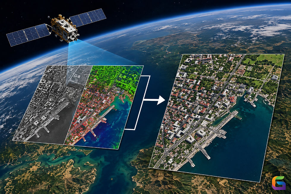
Satellite-based remote sensing has emerged as one of the most potent technologies for Geographic Information Systems (GIS), facilitating accurate Earth observation, spatial analysis, and industry-wide decision-making. Organizations can monitor land cover, identify environmental changes, and optimize resource management with previously unheard-of accuracy by combining satellite imagery with GIS platforms.

What is Remote Sensing by Satellite?
The practice of gathering data about the Earth's surface without making physical contact—usually using satellites or airborne sensors—is known as remote sensing. In order to create data that can be converted into pictures, elevation models, and thematic maps for GIS applications, satellite remote sensing uses sensors that pick up electromagnetic radiation that is reflected or emitted from the Earth.
Satellite remote sensing's salient features include:
The capacity to capture vast geographic regions in a single image is known as synoptic coverage.
Multiple wavelength detection for a variety of analyses is known as multispectral and hyperspectral imaging.
Repeated Observation: Ongoing observation for time-based research.
Global Accessibility: Openly accessible datasets from Sentinel, MODIS, and Landsat.
Importance of Remote Sensing in GIS
For spatial analysis, GIS needs precise, current, and georeferenced data. This basis is provided by satellite remote sensing, which offers:
Base Maps: GIS layers are constructed from high-resolution imagery.
Monitoring the environment: keeping tabs on biodiversity loss, deforestation, and vegetation.
Urban and infrastructure planning includes managing transportation networks, keeping an eye on urban sprawl, and identifying changes in land use.
Disaster management: Quick evaluation of hurricanes, earthquakes, wildfires, and floods.
Climate studies are long-term observations of land surface, oceanic, and atmospheric processes.
Types of Satellite Data for GIS
Specialized data from various satellites is appropriate for a range of GIS applications:
Hyperspectral and Multispectral Optical Remote Sensing:
Satellites: WorldView, Sentinel-2, and Landsat
Applications include monitoring agriculture, classifying land cover, and mapping vegetation.
Radar Remote Sensing (SAR – Synthetic Aperture Radar):
Satellites: TerraSAR-X, RADARSAT, and Sentinel-1
Applications include topographic mapping, soil moisture analysis, flood mapping, and foggy condition monitoring.
Remote Thermal Sensing:
MODIS and Landsat Thermal Infrared Sensor (TIRS) satellites
Applications include water resource management, forest fire detection, and urban heat island studies.
LiDAR from Platforms in Space:
Satellites: GEDI, ICESat-2
Applications include estimating carbon stocks, measuring the height of the forest canopy, and creating elevation models.
Integration of Satellite Remote Sensing with GIS
The integration of GIS with satellite imagery improves the capacity for spatial analysis:
Georeferencing, atmospheric correction, and radiometric calibration are examples of image preprocessing.
Automated techniques for mapping land cover and tracking changes over time are used for classification and change detection.
Using LiDAR and radar data to visualize the terrain is known as 3D modelling and DEM generation.
Data fusion is the process of combining LiDAR, radar, and multispectral data to provide thorough insights.
Challenges in Remote Sensing for GIS
Even if satellite remote sensing is revolutionary, there are still certain obstacles to overcome:
Atmospheric disturbance and cloud cover in optical imaging.
High data volumes necessitate sophisticated processing and storage capabilities.
The price of commercial high-resolution data for intricate GIS projects.
To evaluate and comprehend complicated datasets, skilled analysts are required.
Future of Satellite Remote Sensing in GIS
The use of satellite remote sensing in GIS is growing thanks to emerging technologies:
AI and machine learning: For predictive modelling and automated classification.
Cloud computing and big data: Large-scale analysis is made easier by platforms such as AWS and Google Earth Engine.
CubeSats and small satellites: offering more affordable, daily high-resolution imagery.
Developing hybrid geospatial ecosystems for real-time monitoring through integration with UAVs and IoT.
Satellite-based remote sensing has transformed GIS by supplying consistent, scalable, and dependable Earth observation data. Smarter, data-driven decision-making is being made possible across industries by the combination of satellite data and GIS, from environmental monitoring to urban planning and catastrophe response. The use of remote sensing in GIS will only increase with the development of AI, cloud computing, and next-generation satellites, which will spur innovation in geospatial intelligence.
For more information or any questions regarding remote sensing, please don't hesitate to contact us at
Email: info@geowgs84.com
USA (HQ): (720) 702–4849
India: 98260-76466 - Pradeep Shrivastava
Canada: (519) 590 9999
Mexico: 55 5941 3755
UK & Spain: +44 12358 56710


Comments